BY CHUCK HAVILAND
The road from Steilacoom to Seattle (aka Old Military Road) started in Steilacoom and proceeded towards Seattle. The original road started within a few hundred feet of the current ferry landing in Steilacoom. Most of this area is marked by street signs which also state that this a “historical district”. The historical museum is located near the center of town.
No sign of the original road reappears until old military intersects with a city street. From that point old military road traverses the same route until you reach Washington Blvd. There is no sign of the original road until you reach Perimeter Rd. on the east side of McChord airfield.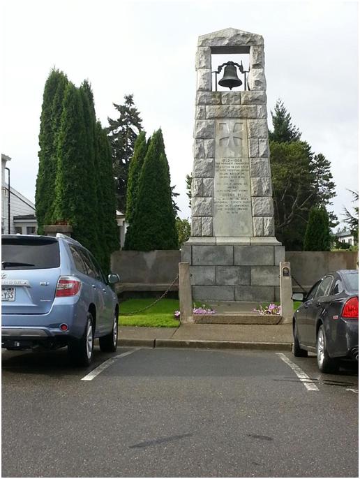
Near the town center is a large bell tower made of stone. Inscribed on this monument is the following:
1853 – 1908 This monument commemorates the erection On this site of the first protestant church building north of the Columbia river in 1853, by Rev. John F. DeVore and his co-workers and friends Erected by the Washington State Historical Society Sound M. C. conference and pioneer friends in 1908.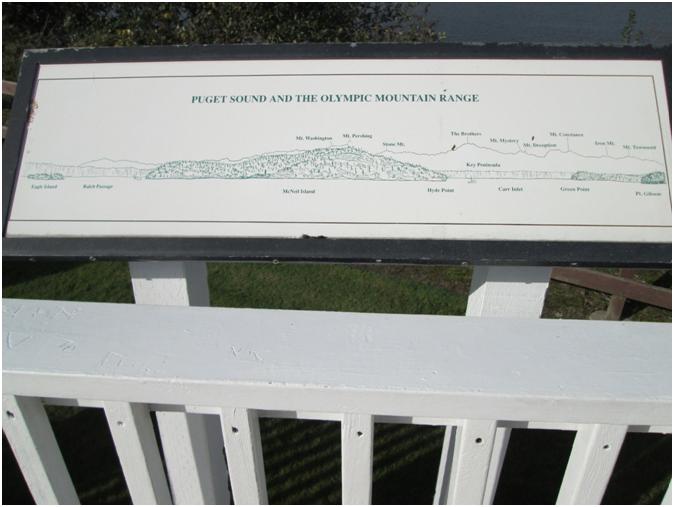
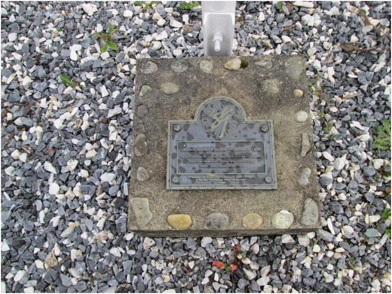
A small park is located nearby. It has two sight-seeing billboards on it. The first describes “Puget Sound and the Olympic Mountain range” This sign shows the locations in view of Eagle Island, Balch Passage, McNeil Island, Mt Washington, Mt Pershing, Stone Mt, Hyde Point, The Brothers, Key Peninsula, Carr Inlet, Mt Mystery, Mt Deception, Mt Constance, Green Point, Iron Mt, Mt Townsend and Gibson Point.
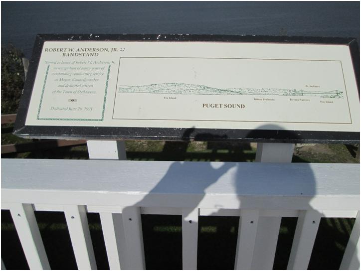 The second sign shows the location on Puget Sound of Fox Island, Kitsap Peninsula, Tacoma Narrows Point Defiance, and Day Island.
Near the parks entrance is a concrete or stone marker.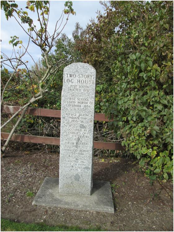
Prairie House Museum January 1889
I found a military road marker near Sprinker Park, made of stone and mortar, pyramid shaped marker, about 5 feet tall. On it there is a brass plaque with the following data on it:
 “FIRST MILITARY ROAD IN WASHINGTON FROM FORT STEILACOOM TO FORT
WALLA WALLA VIA NACHES PASSS CROSSED THE HIGHWAY HERE LOCATED
a. D. 1853-54”
“THIS MEMORIAL ERECTED BY WASHINGTON STATE HISTORICAL SOCIETY-A. D. 1922”
On an additional brass plaque lying flat on the ground in front of the large marker;
“ROAD CONSTRUCTION RELOCATION MONUMENT 900 YARDS NW FROM THE ORIGINAL SITE July 1978 a, d,” ROAD MONUMENT
Old Military road reappears on B Street It meanders in an Easterly direction until you reach Canyon Road where the original road disappears until you reach N. Meridian. From this point it’s well defined to the shores surrounding Elliott Bay.
The inscriptions on the concrete post marker in the park are described as follows: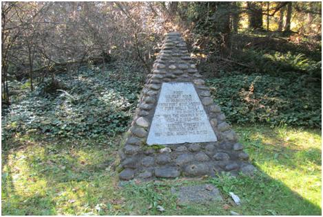
TWO STORY LOG HOUSE Just south Erected 1852
First school session North of Columbia 1854
Refuge during Indian war 1855 – 56
Occupied by Families of Rev JF Devore 1853
Abram Wollery 1854
Sherwood Bonney 1854 – 56
Erected 1961 Pierce County Pioneer Historical ass’n

Great article!
Very interesting article. What about the marker on Steilacoom Blvd across the street from the Western State Hospital?