By Chuck Haviland
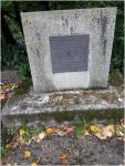
The Byrd Mill road was built from Steilacoom to the Puyallup valley. Its construction was at the request of the Oregon Territorial Legislature. It started in Steilacoom and proceeded Eastward. From the beginning it was a separate road from the 1854 Old Military Road. The Byrd Mill Road is clearly defined on the ground and by the monuments which I’ve found. The first monument (Figure # 1) that I have recovered is on the plateau above Steilacoom, near one of the entrances to Western State Hospital. The brass plaques on it identify the two roads. The next monument (Figure # 2) which I found was in a shopping center, it recounted the Indian Chief Leschi death. The next monument (Figure # 6) which tied the Byrd Mill Road to the outfall at American Lake. The next point is a series of monuments at the park (known as Byrds Square) on S. 84th Street. See Figures #3, 4, 5 and 7. These 4 monuments affirm the location and relationship of Byrd Mill Road, not only as an access to Andrew Byrd’s sawmill and his grist mill, but also as an escape route from the Puyallup valley to Fort Steilacoom.
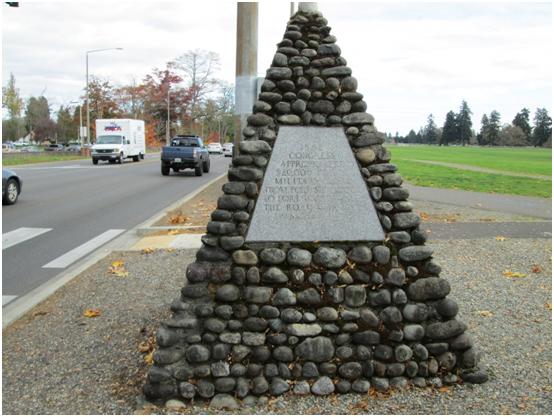
Figure #1 is a stone and mortar marker on Steilacoom Blvd. On this marker are several plaques with the following
Inscriptions:
1) “Congress appropriated $20,000 for the construction of a military road from Fort Steilacoom to Fort Walla Walla, the road was made passable 1853.”
2) “1857 Congress appropriated $35000 for a military road from Steilacoom to Bellingham. This memorial erected by the Washington State Historical Society 1928.”
3) “Supplementing the appropriation made by Congress citizens helped build the military road through the Naches Pass to Walla Walla.”
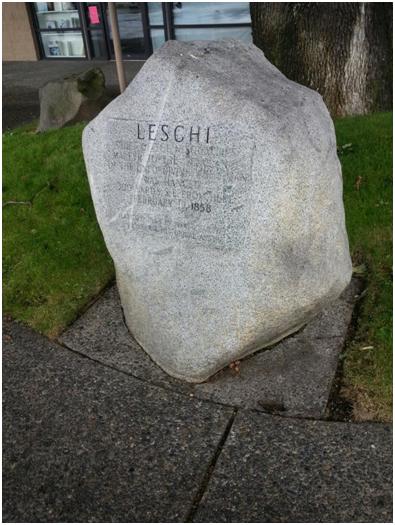
Figure #2 is a boulder with the following inscribed on it: “LESCHI Chief of the Nisquallies martyr to the vengeance of the unforgiving white man was hanged 300 yards S E from here February 19, 1858 erected 1963 by Pierce County Pioneer and Historical society”
Figure #3 is marble (?) plaque with the following inscriptions “In memory of the Fern Hill Boys who gave their lives in World War II 1941 -1945”
John C. Johnson Emory H. Leamon
William J. Turner Robert L. Marshall
Douglas Dean Harley W Buechler
Russell E Deritis Charles J Mulderig
Lawrence M Ganes Arthur Raines
David B Morgan Gerald B Holmes
Wallace E Schwiesow Verne Colwell
James H Kleyn James C Mohn
John R Kleyn Delbert G Berchot
William V Porter Dean W Gustafson
Robert J England Lorenz F Siegel
Earl S Thompson Donald M Joy
Ernest Livermore Kenneth C Schulz
Oscar J Rambeck
They died so that we might live as free men
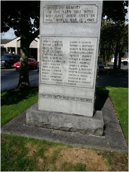
Figure #4 is a sign board with the following inscription In commemoration of Washington historical road number one (now 84th Street). The old covered wagon route also known as the Byrd’s Mill Road was established in 1852 by the Oregon Territorial legislature it extended from the Puyallup valley to Fort Steilacoom as an escape route the valley during the Indian Uprising of 1855. The road was re-established by the Washington State Legislature in 1941 as a tribute to territorial pioneers.
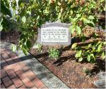
Figure #5 is a small sign in this memorial park and is inscribed as follows “In honor of all veterans who served in the armed forces of the United States” —– dedicated June 14, 2000 by the fern hill community Partnership
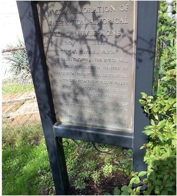
Figure # 6 Is a plaque on a concrete marker near chambers creek– BYRD MILL SITE – Andrew F. Byrd built a dam and a sawmill here In 1853
100 yards downstream he built a gristmill
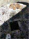
Figure # 7 is a block from the grist mill inscribed as follows “Millstone used in grinding grain at Byrd grist mill. Built 1857 at head Chambers Creek”

Chuck, I have a picture I want to send to you. for your article about the Byrd Road.
Kathleen Benoun
Western State Hospital Historical Society
I’m a new reader of the Prairie Post and love it!! Great job!! Are you able to put gps coordinates in for the spots visited?
I would if I had one. Would need a donation. I am certain Chuck does have one.
Thanks for the interest. I will include latitude and longitude where possible on future articles. Chuck
there is also a stone/rock infront of the fern hill library. Written in the stine it says Byrds Square and dates. This is what me me research and read your article. Thank you!
And a block away, the two (old/new) markers for the Indian Henry Trail at Thompson & 84th.